By Nick Corbo-Stewart, Archivist and Volunteer Coordinator
In this series of blogs looking at new collections at West Sussex Record Office (WSRO), I will continue to guide you, the reader, through the variety of work undertaken by the volunteers. Through a culmination of sorting, listing, ordering, cataloguing and packaging, their completed collections are now open for use by our researchers with the ability to inform and educate all who have an interest in the history of West Sussex. This blog edition focuses on three smaller projects or single item collections completed by the volunteers:
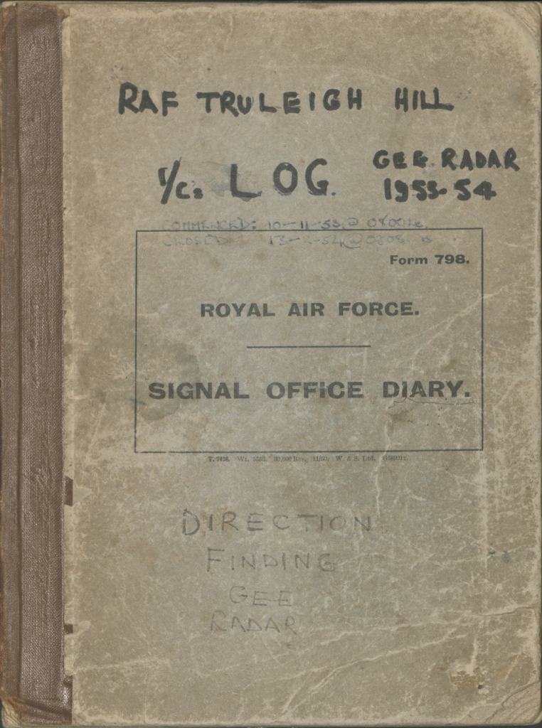
RAF Truleigh Hill, Stoney Lane, Shoreham
Catalogue reference: AM 1858
When thinking about the defence of the skies above Sussex during the 20th century, the locations of Royal Air Force (RAF) bases at Tangmere, Ford and Shoreham spring to mind. However, less well known is RAF Truleigh Hill, situated on the South Downs above Shoreham. It was the site of a radar station and played a vital role in national defence. Here, a sprawl of buildings, bunkers and technical structures, hidden from public view, acted as a link in the Chain Home (CH) network during World War Two and the later Cold War early warning system. In service until 1956, the station was closed as new technology developed, superseding the need for the site.
This collection comprises one item: an RAF Signal Office Diary, with entries dated 10th November 1953 to 13th February 1954. It is a record of everyday operations of the station it served, an environment where communication of accurate information was vital. Within the volume, each page is headed by the date and station number, and then split into three columns. The first denotes the duty (Watch) times. The second, ‘Remarks’ includes notes by those on duty or ‘watch’, when the station was active or in-active (interference and shutdowns were part of the routine) and information about the activities of neighbouring stations. The third contains the initials of those making the remarks. Entries are sporadic, sometimes made every hour, or within minutes of each other. Over the course of day, many contributors added to this volume. It reflects an extremely busy, alert environment, but with the underlying tension of always having to watch the skies.
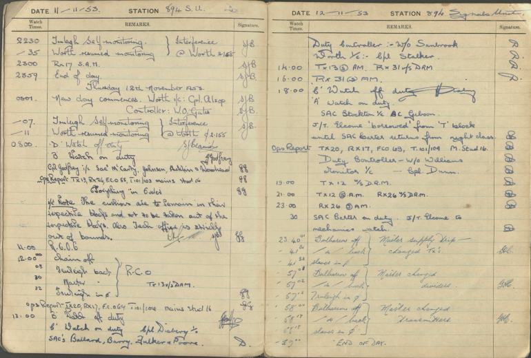
AM 1858/1
Ordnance Survey map of Chichester, 1973
Catalogue reference: PM 1318
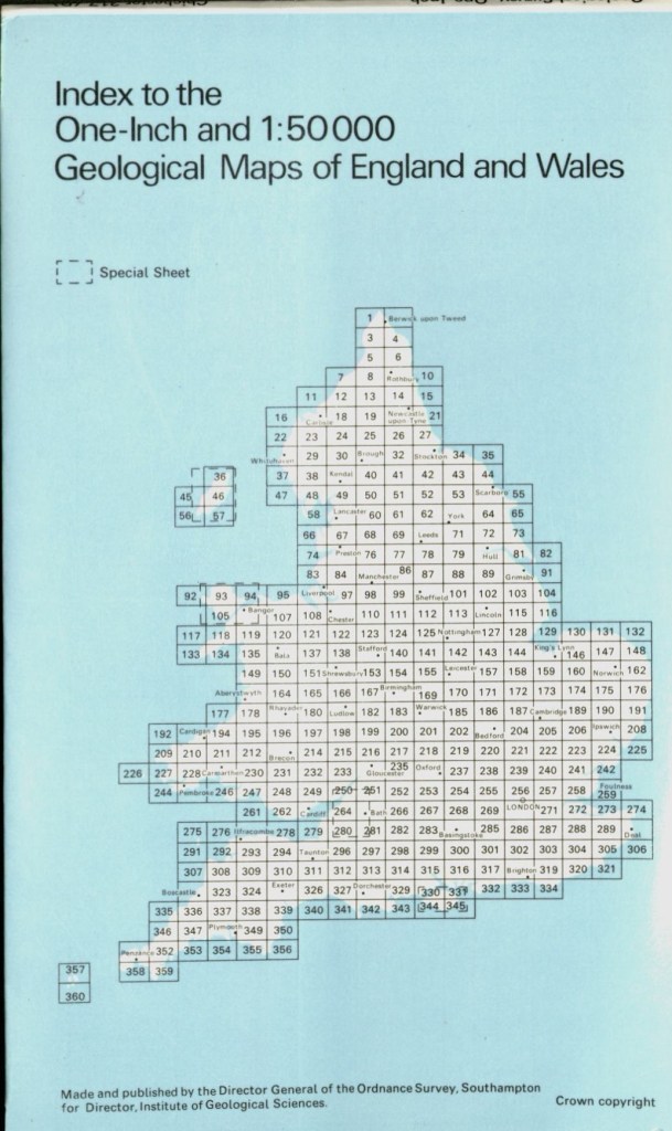
Formed in 1791, The Ordnance Survey (OS) is the national mapping agency for Great Britain, headquartered in Southampton. This cartography organisation has been producing detailed maps for all kinds for uses, although it is probably best known for its leisure maps. Less well known are a series of geological maps it created in partnership with the Institute of Geological Sciences (subsequently renamed the British Geological Survey), commencing in 1973.
AM 1858 is described as sheet number 317, Drift edition and consists of a single, folded sheet. Printed upon it is an introductory description, index, section and colour scaled map. Most of the item is taken up by the drift map, depicting distribution of sediments like glacial, fluvial and marine deposits, on a scale of one inch to one mile. A kaleidoscope of bright vivid colours, it shows what is hidden just below the surface of the ground. The area covered stretches from the coastal plain to the South Downs. Chichester is in the southwest corner, with the Arun River Valley to the east and South Downs to the north. An index, to the right, notes the different types of deposits found on the map and their relative. Below the map is a section; a traverse of the lower coastal plain on the left to the higher ground of the South Downs on the right. For ease of surface reference, the locations of West Chiltington and Highdown Hill are marked. Overall, it is an item which gives us a very different view of West Sussex.
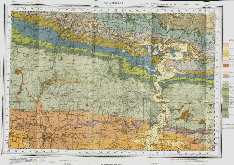
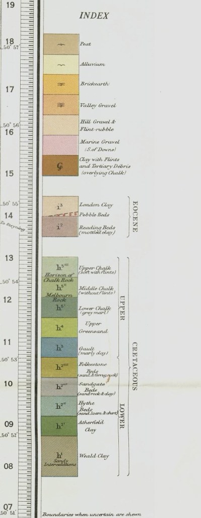
PM 1318
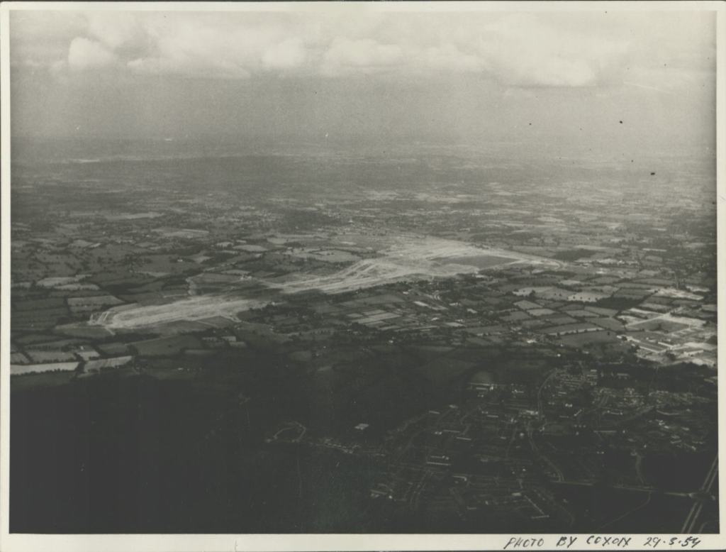
Photograph of Gatwick Airport
Catalogue reference: PH 32560
Situated in mid-Sussex, north of Crawley, Gatwick Airport is a major transport hub of the UK and also one of the biggest employers in West Sussex. Developed as an aerodrome during the 1920s, with commercial flights starting in the 1930s, it was taken over by the military and re-named RAF Gatwick. After the war, the airport returned to civilian use. To take advantage of this growth of civil traffic during the 1950s, major development work took place. Construction of new airport buildings, designed by Yorke Rosenberg Mardall, proceeded from 1955 onwards.
This photograph is an aerial view taken from the south. It shows construction around the airfield during 29th May 1957. Visible are the taxiways and runway, surrounded by a patchwork of fields and smaller settlements. To the south are the suburbs of north Crawley and what was left of the settlement of Gatwick itself. To the east can be seen the London to Brighton railway line, providing main access to the airport. Overall, the image shows a stark contrast to the modern day terminals and M23 link road, later 20th century additions. The photograph highlights the openness and space of the site, ideal for the up-and-coming jet age.
Stay up to date with WSRO – follow us on Facebook, Instagram, Threads and YouTube
