By Abigail Hartley, Searchroom Archivist
Maps are one of the most useful resources for family, local, and house historians. They can tell you about the age, changing shape and structure of properties, as well as shifting land usage and ownership. They are also worth looking at in more depth as records in of themselves. Moving backwards in time, we’ll look at the changing usage of maps, why they were created, and where West Sussex sits in the grand scheme of mapping Great Britain.
In this blog we look at OS and Tithe maps.
OS

Chances are you have used or seen an OS map in your lifetime. Ever reliable, ever accurate, Ordnance Survey’s own website goes into greater detail of the organisation’s history than what can be written in this blog; but, as the word ordnance hints, it has its origins tightly woven in with the military. It was originally conceived as a task to map Scotland after the Jacobite uprisings, then for England after fears of invasion from Napoleon decades later.
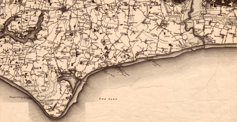
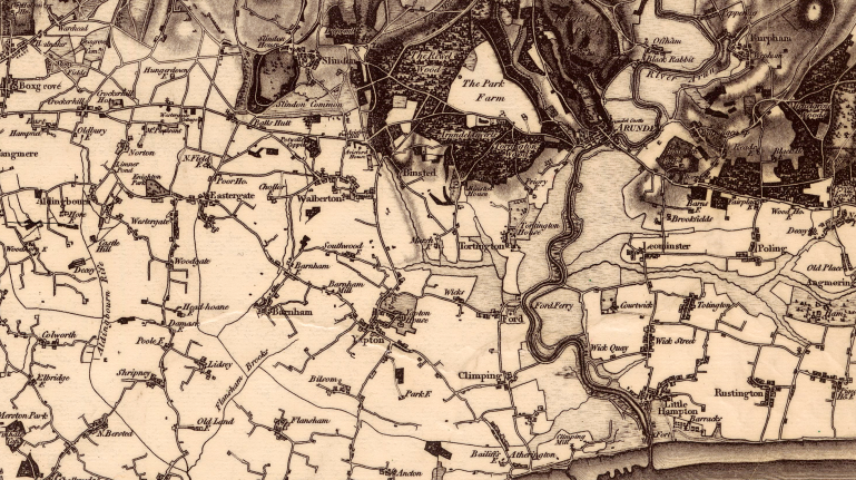
The first Ordnance Survey was published in 1801 which detailed the County of Kent, with other counties following over the next twenty years. These initial editions were not cheap to buy (reflecting how much work went into the drafting of these maps) costing £3 3s per county, which could be as much as three weeks wages for some buyers. The Sussex one in particular was heavily based off of Yeakell, Gardner and Gream’s mapping efforts in previous decades (more on those in the next blog).
The mapping process was slow, with the original surveys had been one inch to the mile, and the initial fifty-year target was not to be. The first complete series for the entire country wasn’t published until the 1870s. Different scales were introduced such as six inches to the mile for mountainous regions, twenty five inches to the mile for rural areas, and ten and a half feet to the mile for busy urban areas.
Both World Wars led to huge growth in the Ordnance Survey’s map making efforts, printing 20 million maps in WWI and 342 million maps in WWII. The latter part of the 20th Century saw more changes. The Ordnance Survey Director General position became a civilian post in 1974, and indeed the organisation as a whole moved away from its military origins, but retained the name in reference to its military past.
Nowadays many of the maps can be viewed after digitisation projects on the National Library of Scotland’s website at https://maps.nls.uk/. Here at WSRO we hold a fairly complete run of maps for West Sussex both in paper and microfiche format for the first through third editions, with urban areas covered by later editions. If you have ever done house history here at West Sussex Record Office, chances are you will have looked at our copies of the First through Third Editions.
The different editions can be tricky to get a handle on. Typically the dates of the surveying versus the date of publication can be a number of years apart. In terms of when the surveying was done, First Edition predates 1874; Second Edition predates 1897; Revised Second Edition predates 1904; Third Edition predates 1919; the abandoned Fourth and Popular Editions predate 1926; the abandoned Fifth Edition and War Revisions predate 1939 and 1945; Sixth Edition predates 1947; Seventh Edition predates 1962; and finally the Landranger series goes from 1974 onwards.
Tithe Maps
The word Tithe comes from one tenth, as in a one tenth payment to be made to – in England’s case – the local parish church. A tenth of what depended on the residents of the parish. It could be a tenth of the yield of corn, wood, hops, wool, milk, pork, or fish for example. This obviously was not at a fixed rate, and the yield would vary wildly. Maybe the parish church didn’t need another three lambs, but it was what they received each year.

Conflicts arose often. The dissolution of the monasteries with the Reformation made this worse, and with land being sold into private hands, people were unsure of what exactly they were paying for and to whom. Another source of conflict was religious sectarianism. With splintering religious factors in the 17th and 18th centuries, it made little sense, for example, for Quakers to pay money to a church they did not attend. It is possible to read many disputes in Episcopal Depositions (found under Ep/I/10 and Ep/I/11 on our online catalogue). However, a word of warning: they can be quite dry, not to mention many are in Latin.
The system had lumbered along, but with inclosure awards changing once more who owned sections of parish lands, plus increasingly common disputes over who owed whom what, a set rate of fees (in money, not goods) was required.
The Tithe Commutation Act 1836 replaced the ancient system with monetary payments and required the surveying of land to determine what was owed to whom and where. Thus, the Tithe maps were produced. They showed sectioned off plots of land and listed the current occupier, owner, rent and other details that have in hindsight become such a valuable resource for family and house historians.

Each map is signed by the surveyors. 
This map also includes Walderton
Surveying was completed between 1841 and 1851. Three copies of each map was made. One went to central government (and is now held at the National Archives), one to the Diocesan (and subsequently the corresponding Diocesan Record Office), and one to the parish to whom the map referred.

TD/W168 – Edburton Tithe Map, 1842. This Tithe map has been carefully coloured in 
TD/W168 – Edburton Tithe Map, 1842. This section shows Fulking village
The modern-day physical condition of these maps varies wildly, both in the way they were stored and how often they were consulted. In a stark example, St Peter the Great parish, Chichester, is nearly unreadable. Edburton parish, on the other side of the county, is beautifully preserved.

TD/W29 – Chichester, St Peter Great’s Tithe Map, 1846, has not gone through the years unscathed 
TD/W168 – Edburton Tithe Map, 1842, comparatively, is in much better shape
Here at WSRO, our Diocesan Tithe maps were digitised in 2007 by Icam Archive Systems as part of a project funded by the Heritage Lottery Fund, West Sussex Archives Society and The Golden Trust, alongside nearly 100 volunteers. They are available to view on our Archangel packages on our public access computers. They are also available to be ordered if you wish to have a copy of your own (see our website for more details) and some local libraries have copies of the Tithe maps for their local area.
The payment of Tithe as a practice dwindled over the next century, with the Tithe Acts of 1936 and 1951 affecting who was liable to pay, and finally the practice was ended with the Finance Act in 1977. The maps remain one of the best resources for family and house history.
Next time, we look at Estate and County Maps.
Stay up to date with WSRO – follow us on Facebook, Instagram and Twitter


