
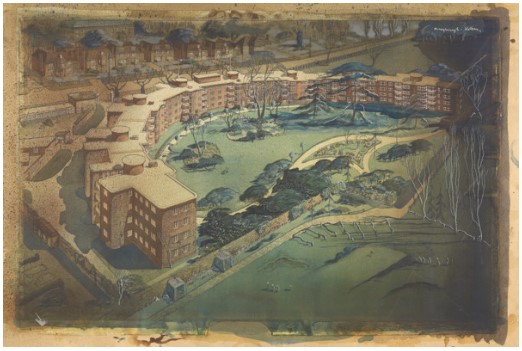
Each development corporation managing the building of a new town produced a master plan. This document, or documents, outlined the vision for the new town and went into detail about the provision for housing, amenities, shops, schools and leisure places. Accompanying the documents were a series of large scale planning maps which visualised aspects of the plan such as the stages of development, existing gas lines, and the intended location of schools and shopping centres. Given their importance, it’s no surprise that they are beautifully drawn and are some of the best preserved items in the Crawley New Town archive. Read on to find out more about these plans.
Thomas Sharp
Crawley Development Corporation’s first consultant town planner was Thomas Sharp. He was responsible for Crawley New Town’s initial master plan which he drafted throughout 1947, the year that Crawley was designated a new town. Sharp had made a name for himself in the 1920s, fostering a reputation for a bold and uncompromising attitude to his work. Interestingly, in January 1947, Chichester City Council engaged Sharp to advise them on re-planning the central area of the city.
Despite several months of hard work, Sharp resigned from the Corporation following differences of opinion with the Corporation’s chairman, Thomas Bennett. This was not Sharp’s first resignation under such circumstances.
The first few maps in the blog are by Sharp, and even after his departure these were still utilised by his successor Anthony Minoprio.
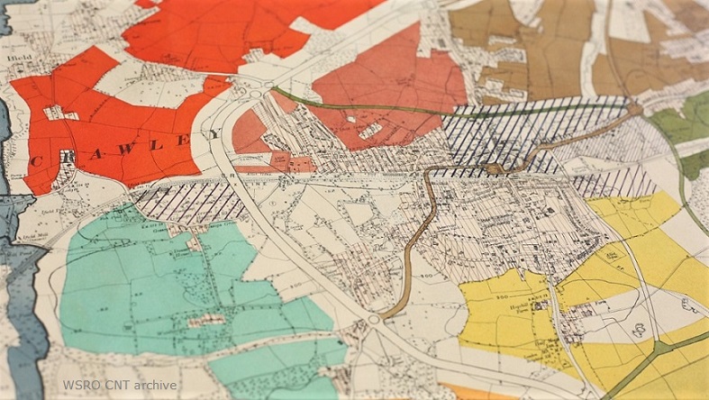
Suggested Stages of Development plan, 1947
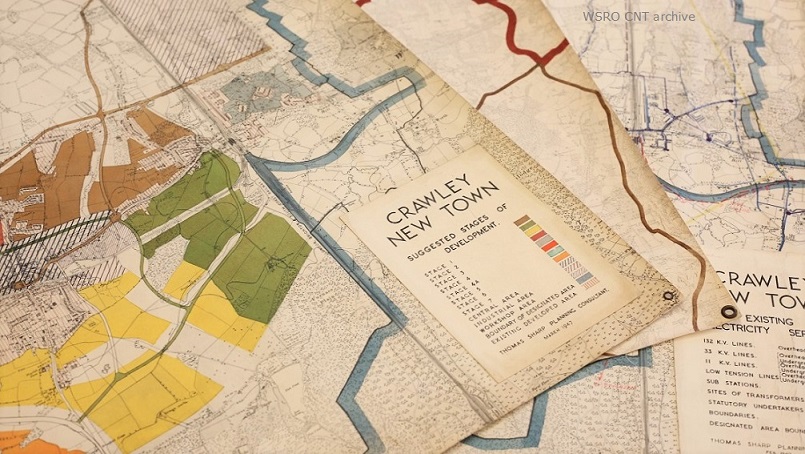
Prepared in March 1947 by Sharp, this plan visualises the suggested stages of development, i.e. the order in which neighbourhoods and areas were to be built. The first neighbourhood to be built was West Green, followed by Northgate, Three Bridges, Langley Green, Pound Hill, Ifield, Southgate, Tilgate and Gossops Green. The neighbourhoods of Broadfield, Bewbush and Maidenbower were built in 1969, 1974, and 1980 respectively.
This plan was not just useful to the Corporation, but an ideal way to communicate to the public how the Crawley area would be expanding. It also highlights the areas which were to be reserved for industrial units (factories, etc.) and the enlarged shopping area.
A working copy of a similar map by Sharp can be seen through this link here.
Major Farm Units plan, 1947
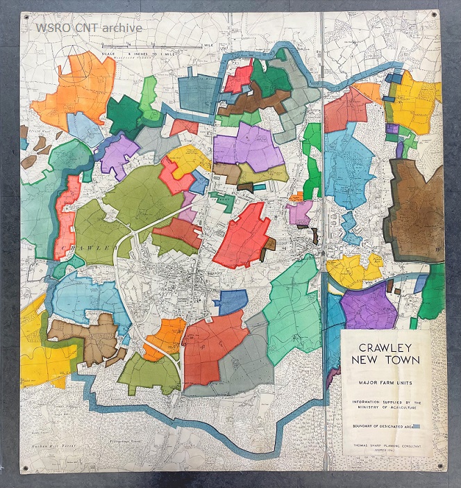
More colourful than even the development stages plan, this particular plan shows the various major farms in the Crawley area. It would have been a very useful depiction of the farmland required for building sites. As a government sanctioned organisation, the Corporation had the power to issue compulsory purchase orders. These orders allowed them to acquire land that was needed to build the planned new town neighbourhoods on. There are 27 farms identified on the plan, including Broadfield Farm, Tooveys Farm, and Brooklyn Farm to name just a few.
Utilities and Amenities, 1947
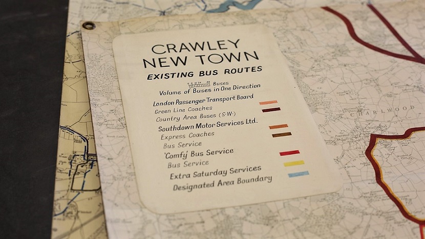
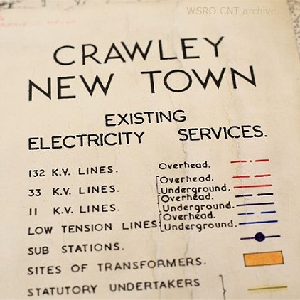
Perhaps less relevant to the general public at the time, but absolutely crucial to the Corporation’s engineers and architects, were the plans produced to show existing gas lines and electricity and bus services.
For obvious reasons, I expect that these plans would have been referred back to quite frequently, more so than the above two. This being said, they’re in equally good condition, even having reinforced pin holes so that they would not tear easily when displayed.
The plan of the bus routes is particularly interesting as a piece of social history, documenting the provision of public transport in the area and telling us which bus companies were active at the time.
Anthony Minoprio
After Thomas Sharp’s departure in June 1947, Anthony Minoprio was brought in to draft a new version of Crawley’s master plan. This draft was published in the following December. Initially, Minoprio was planning a town for 50,000 inhabitants who were to be migrants from London, but this increased to almost 68,000 inhabitants by 1961. Today the town’s population stands at over 100,000.
Like Sharp, Minoprio’s work was highly regarded and he had a track record of designing buildings such as the extension to Liverpool’s Royal School for the Blind and the distinctive Fairacres apartments in Roehampton. You will see below Minoprio’s master plan of 1949, which is the finalised version of his 1947 draft.
Anthony Minoprio’s Master Plan, 1949
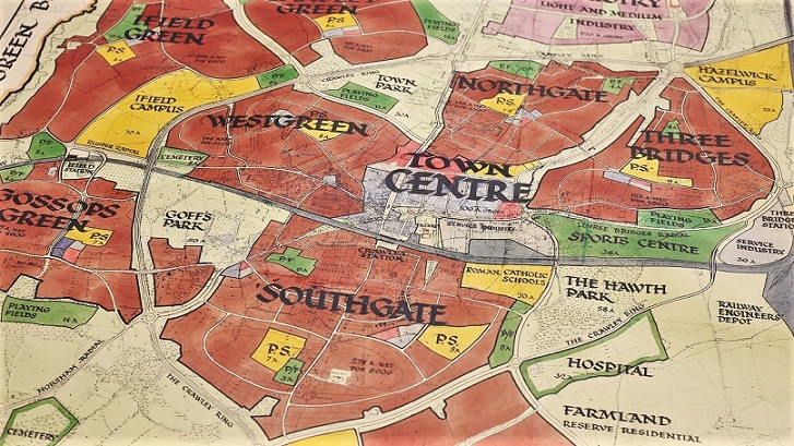
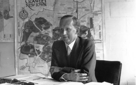
This is the map which accompanied Minoprio’s final written plan for the new town, published a year to 18 months after he developed his draft versions. It is very large and measures 145cm by 135cm. The calligraphic script is a departure from Sharp’s earlier plans, which suggests that this plan may have been exhibited to the public at some stage. However, a photograph of the Chief Architect, H S Howgrave Graham, shows the map on display behind his desk.
The solid red areas clearly illustrate the size of the numerous satellite neighbourhoods (Northgate, Southgate etc.) in relation to the town centre and the industrial area to the north.
One of the most interesting elements of this plan is the inclusion of school ‘campuses’. The Corporation planned these campuses to have three secondary schools each, nine in total across Crawley. In the end, this was largely realised but without a Technical secondary school, and the Gossops Green school was not built on a campus.
Later maps and plans for the new town are less finessed, and look much more like the type of worn and torn documents you’d expect in a busy planning office. These maps and plan are particularly unique and special records of the early development era, which will be safely stored in archival packaging in our strong rooms.
The next blog will look at the industrial businesses that moved out of London and took a chance on Crawley. Along with them came hundreds of workers and their families, quickly populating the new town in the 1950s.

Save
LikeLike